By MARIANNE L. SHAFER and ROBERT REDDY

MARIANNE L. SHAFER AND ROBERT REDDY
Dennis
After conquering 13 trails in Falmouth, two not-so-old octogenarians from Falmouth decided to hike at least one trail in every one of the 15 towns on the Cape. Starting in January 2021, our goal was accomplished by early July. We celebrated with fried clam baskets at Kate’s Seafood Restaurant on Route 6A in Brewster while returning home from Provincetown.
We weren’t just going to roam wildly through Cape Cod’s forests, marshes, swamps, beaches, rocks and dunes. We depended on various trail maps. Maps of the Falmouth 300 Committee’s Long Pond trail, plus many other Falmouth trails, were found by searching the web (Falmouth’s 300 Committee Land Trust Trails) and also www.alltrails.com/us/massachusetts. These show many more easy, moderate and difficult trails and maps in each of the 15 Cape Cod towns.
However, we found most of our trail maps in the book “Walking The Cape And Islands” by David Weintraub from Menasha Ridge Press (2006). This highly informative, well-illustrated paperback is available on Amazon.com as well as at the Falmouth Public Library and other libraries on the Cape.

MARIANNE L. SHAFER AND ROBERT REDDY
Eastham
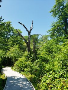
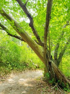
Each walk presented us with different and interesting sights. As we walked the trails along the shorelines, around the ponds and through the woodlands, marshes and swamps, we appreciated the natural beauty of the Cape. The variety and shapes of the trees, large and small, straight and twisting, some fallen into the welcoming branches of a nearby tree, some flat on the ground, never failed to amaze us. A few hollowed-out tree trunks, which we believed were inhabited by small wildlife, fed our imaginations.
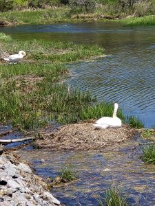
We heard and saw many types of birds. The different types and sizes of rocks, carried here in the Laurentide Ice Sheet and left here in the Cape Cod Moraine when the ice sheet retreated about 20,000 years ago, amazed and fascinated us.
But we soon learned to keep a watchful eye on the trails themselves. Although most are of matted grass, dirt, sand or wooden boardwalks over a stream or marsh, many trails are half-embedded with small to large rocks and roots that are very easy to trip and fall over. As one of us did. Twice. On two different town trails. Words of warning for all trails: Watch your step.
The following is a brief account of the trails we hiked in each of the 15 towns on the Cape.
Trails Hiked by
Two Hearty Octogenarians
(Distances based on using a pedometer)
Falmouth: Long Pond, about 4 miles, 2.5 hours. Moderate difficulty. We walked on a dirt road alongside a small river, past a good kayak launching place and a herring run. We encountered some hilly, rough paths and rocks galore. But to circle Long Pond was a fine adventure.
Bourne: We used no map, just hiked along the paved Cape Cod Bike Trail from the Bourne Bridge almost to the Sagamore Bridge, about 4 miles on the Cape Cod side of the canal. Easy, and interesting to see the canal traffic.

MARIANNE L. SHAFER AND ROBERT REDDY
Mashpee
Mashpee: Two Pond Ramble, 3 miles, 1½ hours. Easy to moderate difficulty. Also known as the Mashpee-Wakeby Pond Trail. When you get about halfway you can turn right toward Conaumet Point to overlook Wakeby Pond or backtrack to follow the trail to Mashpee Pond. A good hike.
Sandwich: Moraine Ramble, 2.5 miles, 2 hours. Moderate difficulty. If you like to see rocks the glaciers left behind, this is the trail for you.
Barnstable: Sandy Neck, 3.3 miles, 3 hours. Difficult. You are rewarded with great views of Cape Cod Bay and the water birds that frequent the Great Marshes.
Yarmouth: Nature Trail, 1.3 miles, 1.5 hours. Easy. The shapes of many fallen trees will greet you as they lay in their beautiful leafless sleep.
Dennis: Shoreline Loop, about 1.5 miles, 1 hour. Easy. A lot of honeysuckle bushes, a bridge to cross, many dead trees fallen along the way. You will come across many side trails that are not on the map, which means it’s a good place for adventure.
Brewster: John Wing Trail, about 1.5 miles, 1 hour. Easy. An amazing view from the beach.
Harwich: Herring River, 1.8 miles, 1.4 hours. Moderate difficulty. A snapping turtle crossed the road, a bird took a bath in in a pothole and, again, there were many side trails not on the map.

MARIANNE L. SHAFER AND ROBERT REDDY
West Falmouth Bike Trail
Chatham: Morris Island Trail, 1.4 miles, 1 to 2 hours. Moderate difficulty. Well-marked trails lead to walking along sandy trails on the beach. View a tidal flat and many huge, dead pine trees fallen in interesting configurations.
Orleans: Kent’s Point, about 1 mile, 1 hour. Easy. Very scenic with many waterways and open spaces.
Eastham: Red Maple Swamp and Fort Hill, 1.5 miles, 1.5 hours. Moderate difficulty. Here you will be walking the Nauset Marsh in the tracks of Henry Beston’s Outermost House. Bring insect repellant to keep the mosquitoes away.
Wellfleet: Atlantic White Cedar Swamp Trail, 1.3 miles, 1.1 hours. Easy. Plenty of boardwalks over the swamp, well-marked with good views.
Truro: Bearberry Hill and Bog House, 1.8 miles, 1.5 hours. Moderate difficulty. We counted many stairs (64) but could not count the many insects. Bring bug spray. A steep, invigorating trail.
Provincetown: Beach Forest Trail, 1.2 miles, 1.1 hours. Easy. Nice dunes, a steep trail, clusters of mushrooms and many roots, large and small.
What’s next for these two active, young-at-heart Cape Codders? A possible kayak trip on one pond in each of the towns on the Cape. Maybe a saltwater swim off each of the town’s beaches? Then again, it could be time to sit on our deck and consume a glass of our favorite wine while reminiscing over our walks in all 15 towns on the Cape!

