
By Barbara Clark
Autumn is a great time to investigate some of Cape Cod’s unique trails and its special land-meets-sea terrain. As far as Cape Cod scenery goes, it’s not all rolling ocean breakers and dunes here. More than 20,000 acres of the Cape’s habitat consists of marsh and woodland areas, which provide a crucial birthing ground for the Cape’s “blue” ecosystems.
GENE M. MARCHAND/ENTERPRISE
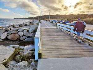
The Shining Sea Bikeway at Trunk River looking toward Woods Hole
Upper Cape’s Shining Sea Bikeway Offers a Trip through Time
The Shining Sea Bikeway developed from a bicentennial project that began in 1975, and the railroad bed it was built on follows the Cape’s westernmost shore. It crosses through four of Falmouth’s villages in communities where landscapes are descended from the time of the massive Laurentide ice sheet that blanketed our region more than 20,000 years ago. The bikeway runs from Woods Hole at Vineyard Sound to North Falmouth, along the shore of Buzzards Bay, reaching a final length of 10.7 miles in 2009.
This is not just a bike path where you can get a little outdoor exercise: it’s a trip through time on Cape Cod that travels across salt marshes, woods, barrier beaches and cranberry bogs.
The bikeway crosses the Great Sippewissett Marsh below the village of West Falmouth. This 140-acre protected salt marsh habitat remains an important site for researchers in the Woods Hole scientific community, and according to these institutions, it’s “one of the most studied salt marshes in the world,” home to a variety of life, from tiny sea plankton to quahogs, bluefish, river herring, eels, egrets, great blue herons, red-tailed hawks, osprey, turtles, foxes and deer.
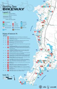 (Shining Sea Bikeway, midpoint access: Depot Avenue, Falmouth, just off Main Street. Bike rentals close by.)

COURTESY LILY PARADISE
Northern Lights glow over the Sandwich Boardwalk
Along the Boardwalks
Walkers, be grateful for the boardwalks that dot our Cape Cod trails. They’re beautiful as well as functional, offering visitors access to fragile environments that would not otherwise be accessible, elevating visitors’ tramping feet well above sensitive soil systems that can quickly turn to mud, and prote cting plants and dune grasses. And you won’t have to wear hip boots or wellies, or scramble through a stand of poison ivy in order to experience these picturesque low-lying areas of salt marsh and barrier beach, marking the places where land and sea intersect.
Sandwich Boardwalk:
On Nat Geo’s Top 10
There was a boardwalk in Sandwich as early as 1875, though the landmark walkway that crosses over Mill Creek has seen countless iterations over the years due to New England storms and temperamental weather. (After Hurricane Bob did a number on it in 1991, boardwalk supporters sold close to
GENE M. MARCHAND/ENTERPRISE
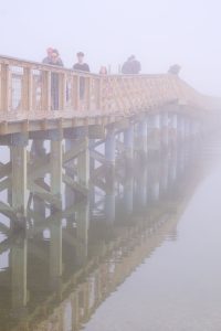
The boardwalk fades into fog.
2,000 personalized commemorative planks to businesses and residents to help rebuild the walk. Many of these, in turn, succumbed during later storms.) The most recent redo, after a 2022 nor’easter, was a total rebuild, finished in 2024.
Million-dollar sunsets and magnificent views of the Cape Cod Canal and surroundings are available free to all walkers, and National Geographic has designated this a Top 10 US boardwalk. The latest reconstruction also added a brand-new diving platform over Mill Creek for adventurous high-tide jumps.
Visitors can traverse the 1,350-foot walkway across salt marsh and tidal creeks, ending at Town Neck Beach for a swim or sandy repose. And we’re strictly in it for the nature views. This iconic boardwalk has always thrived without arcades, shops or other tourist “attractions.”
(103 Wood Avenue, Sandwich. Access off Boardwalk Road)
Gray’s Beach, Bass Hole
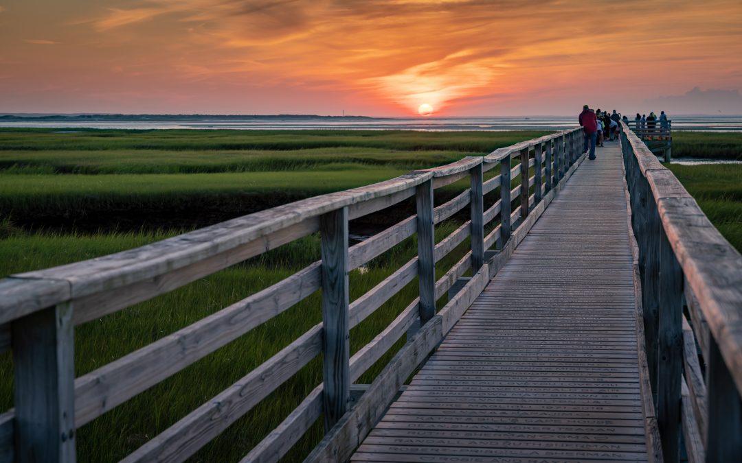
A walk along the boardwalk over the scenic tidal marsh at Gray’s Beach is an easily accessible half-mile round trip out across the marsh at Bass Hole in Yarmouth Port. This popular trek might be best known as the place to capture a multihued sunset or enjoy a view of ocean, barrier beach and salt marsh from the boardwalk’s roomy viewing platform. The rebuilt structure, just now reopening after storms in 2024 caused extensive damage, offers picturesque surroundings, nearby osprey nests and close-up views of fish, crabs and other marine creatures beneath the walkway. This is one of the most popular and easy-to-get-to boardwalks on Cape Cod.
(400 Center Street,
Yarmouth Port)
New Kid in Town:
Parker’s River Landing
The busy commercial strip of Route 28 between Hyannis and Bass River is not widely known for its greenery and nature, filled as it is with pirate venues, miniature golf, lunch spots and waterparks. But just opening in May this year, here’s Parker’s River Landing, a 22-acre gem of green marsh and calling gulls, set down in the midst of it all, winding out to the ocean and South Yarmouth’s Seagull Beach. Built on the site of a former drive-in theater that was popular in the 1960s, the land was purchased by the town in 1986 to be developed for recreational purposes. In 2015, plans were created to turn the former marshland into a park, and the process of restoring the marsh habitat, reintroducing its native vegetation of trees, shrubs and grasses that had diminished over the years, began.
The new public park showcases walking trails, a kayak launch on the river, a children’s playground area with a pirate ship and large open spaces for town or public events. The park’s centerpiece: a 1,300-foot-long raised boardwalk loop over the restored salt marsh, connected by a 40-foot pedestrian bridge. At intervals and overlooks along the walkway, interpretive panels describe the restoration and natural features of the salt marsh and its flora and fauna, as well as how the Cape’s climate and habitat help support this ecosystem. Many boardwalk planks are inscribed with personal dedications, and overlook benches face Lewis Bay and the ocean beyond.
Meggan Eldredge, Yarmouth’s director of community development, called community feedback on the new park “100% positive,” with special praise for the new boardwalk. Eldredge hopes the walkway will help increase local knowledge “of how important salt marshes are to our coastal resiliency.” All this as we stand on the platform looking down at hundreds of lively crabs pursuing their marshy lives, blowing bubbles and doing their crabby gait among hundreds of their friends, blissfully unaware of the human world above.
According to Eldredge, future plans for the park include a kayak rental facility, as well as artist shanties on the river during the summer months.
(669 Route 28,
across from Pirate Museum)
Mass Audubon Great Marsh Wildlife Sanctuary
On its website, Mass Audubon writes: “Along with its expansive salt marsh views, the [West Barnstable] sanctuary features two open ponds, shady oak woodlands and numerous wildlife.” Combined with neighboring Long Pasture Wildlife Sanctuary, the Great Marsh forms “an integral part of the ecologically significant 3,800-acre Sandy Neck salt marsh and barrier beach system.” It is also an important stopover location for migrating birds.
The walk has a trail loop of a little over a mile. Imaginative visitors might wish to keep an eye out for a possible glimpse of the legendary and elusive “Marsh People,” small beings the color of “marsh mud” who are rumored to be phantom descendants of the long-ago inhabitants of Puritan New England, and who might appear in the marsh on a dark and foggy Cape Cod night. Legends persist of travelers pulled down into the mud at the hands of these shadowy apparitions.
(2444 Route 6A, West Barnstable)
Mass Audubon Long Pasture Wildlife Sanctuary
The All Persons Trail at Long Pasture is one of only 18 such trails in Massachusetts. Conceived and designed in 2024 by Mass Audubon staff and the Barnstable Disability Commission, and constructed through efforts of the Appalachian Mountain Club, the goal is to “expand access to the outdoors for all.” By removing barriers of access for people with various disabling conditions or mobility challenges, Long Pasture Director Ian Ives said, the trail is “making it possible for more people than ever to experience the physical, emotional and restorative benefits of time spent outdoors…[It further] offers a variety of adaptive equipment and resources for visitors to borrow, including an all-terrain wheelchair, all-terrain walker, floating beach wheelchair, and tactile maps.”
Ives said the 1,900-foot trail, which begins and ends at the sanctuary’s Discovery Center, traverses “five diverse habitats, from salt marsh and tidal flats to forest and freshwater pond.” The post- and rope-guided trail has several multi-use seating areas and also features a tranquil scenic overlook of Barnstable Harbor and a platform and bridge constructed over an “active wildlife pond.”
(345 Bone Hill Road, Cummaquid)
Taylor-Bray Farm
Spaghetti, a 10-year-old Scottish Highland cow with beautiful curved horns, relaxes in the shade on a recent morning at Taylor-Bray Farm in Yarmouth Port. She lives at the farm along with a number of other resident animals, including pygmy goats, a couple of dozen chickens, some sheep, and Nestor and Sam, miniature donkeys who have lived here for 20 years. The 23-acre farm property, open daily to the public, is nicely mowed with a garden off to the side, currently sporting some ripening tomatoes and other orderly-looking rows of vegetables, and what looks like a patch of red and yellow nasturtiums in their midst.
Cross in front of the picnic tables at the 1890s farmhouse and you’ll see a picturesque boardwalk leading 180 feet out over the Black Flats marsh. It’s a lovely warm-day thing to do, with butterflies and flowering plants in the marsh, and distant views of Chapin Beach and Cape Cod Bay.
(108 Bray Farm Road North, Yarmouth Port)
Red Maple Swamp
Autumn might be one of the best times to do this eight-tenths-of-a-mile loop walk, what with the trail’s name describing the red, orange and yellow leaves that form a lavish yearly blanket of fall color. The trail habitat reflects the preference of these familiar New England trees: “They like their feet to be wet.” Photographers and birders can enjoy lush forest scenery and an inviting boardwalk runs through the swamp area, raised above the marshy terrain. Signs along the way identify native plants. A connected, alternative Fort Hill loop offers a choice to combine two National Seashore trails in a kind of figure eight, adding another mile, with water views.
(70 Fort Hill Road, Eastham)
Atlantic White Cedar Swamp
This scenic 1.2-mile loop in the Cape Cod National Seashore trail system winds through a forest of Atlantic white cedar, and the boardwalk portion of over a half-mile shows off the mystical beauty of these native trees.
Cape nature columnist and artist Mary Richmond shared that she has enjoyed walking these trails many times, noting, “They are not walks to rush through, but to savor.” She added, “Both the Red Maple and White Cedar swamps are excellent places to find birds, wildlife and a variety of plant life. The White Cedar Swamp, however, has a bit of mystery to it, with the dark red water and bright green mosses puddling around the roots of the cedar trees. There are turtles and salamanders, owls and woodpeckers among many other species. No matter the season, it is always a delight, but in the late fall it is an excellent spot to share spooky stories and give yourselves a shiver.”
(195 Marconi Station Road, Wellfleet.)
Note: Salt marshes naturally accumulate elevation over time, trapping sediment and building up organic peat. Ongoing research from the Marine Biological Laboratory suggests that current rising sea levels, due partly to our human activities, have put many of these salt marsh areas in danger. A host of local and state organizations, as well as the National Park Service, are working on ways to revitalize many wetlands through tidal restoration projects that may “reintroduce natural tidal flows and help surviving salt marshes adapt to rising waters.”